

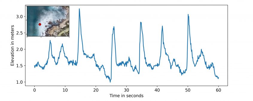
Over the past two weeks the SIO group has also been doing UAS flights with lidar but at China Rock. See Matt’s post from July 16th at Asilomar. Similar to the Oregon State group, our strategy has been principally to hover in space for ~12 minutes usually over an instrument – see the China Rock instrument map below. An example … Read More
Saturday July 16 – Measuring Waves from the Sky
When you imagine going to the beach, what’s the first thing you think of? Perhaps it’s sand or sun, perhaps it’s rocky intertidal areas, or perhaps it’s waves. Those waves that you may love to surf are also a critical aspect of coastal systems from many different perspectives. As waves approach the shore and break, they bring energy and momentum … Read More
Tuesday July 5th: An echo beneath the rolling waves

Walk around Asilomar and you will see giant rocks along the shoreline. But what does the ocean floor look like off from the coast? How big are the rocks that we can’t see beneath the surface of the ocean? These are crucial questions in ROXSI because the shape of the sea bed determines how the waves shoal and break as … Read More
A Structure from Motion Perspective of the Small-Scale Array
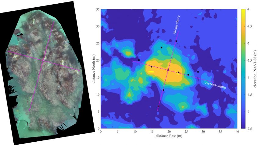
Left: Ortho mosaic of the instrumented rock at Asilomar, obtained by stitching GoPro photos. Right: multibeam bathymetry with instrument positions indicated by black dots. Magenta lines are across-shore and along-shore transects along which instruments were placed. On the last day deploying instruments in the small-scale array, visibility was amazing and we could even see the instruments from the surface. Loren … Read More
novel coherent alongshore array – decades in the making
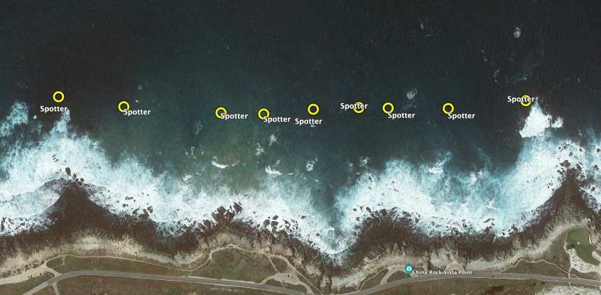
Nearshore oceanographers have long been interested in edge waves that are ubiquitously found on sandy shores; from Huntley, Guza, Thornton (Torrey Pines, early 80s) to Oltman-Shay, Howd (Duck, early 90s) to Sheremet, Noyes, Guza, Feddersen, Elgar (Duck, late 90s) and MacMahan, Reniers (rip channeled beach in Monterey, early 2000s); amongst many others. Edge waves are low-frequency waves that are refractively … Read More