
The second field experiment of ROXSI was completed from September-November 2023 at Stanford University’s Hopkins Marine Station. The field experiment included lots of instruments in the water and affixed to rocks, called the Small-Scale Array, as well as shore-cameras and drone measurements. There were some warm days, some cold days, some windy days, some spooky days (Halloween), some big waves … Read More
ROXSI UAV hover of synchronized lidar and georectified images of wave propagating through rocky coast
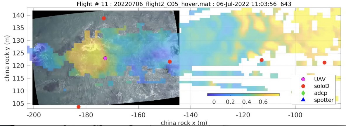
As part of the ROXSI project, we are interested in how surface gravity waves propagate and dissipate through very shallow yet very rocky and rough regions. As part of this we are using a UAV with lidar and camera system to visualize the wave field in places that are challenging to sample in any other way. It took some work … Read More
All instruments back in the lab
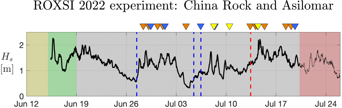
After a busy month and a half, we have officially wrapped up the 2022 ROXSI field experiment! Our boat and shore crews did a superb job and recovered all of our moorings in just a few days. Since algae and kelp are more than happy to grow on our instruments, the first step back in the laboratory is to … Read More
novel coherent alongshore array – decades in the making
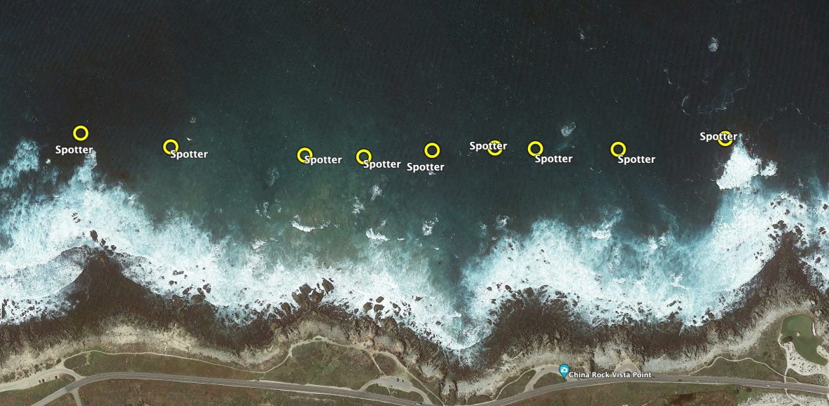
Nearshore oceanographers have long been interested in edge waves that are ubiquitously found on sandy shores; from Huntley, Guza, Thornton (Torrey Pines, early 80s) to Oltman-Shay, Howd (Duck, early 90s) to Sheremet, Noyes, Guza, Feddersen, Elgar (Duck, late 90s) and MacMahan, Reniers (rip channeled beach in Monterey, early 2000s); amongst many others. Edge waves are low-frequency waves that are refractively … Read More
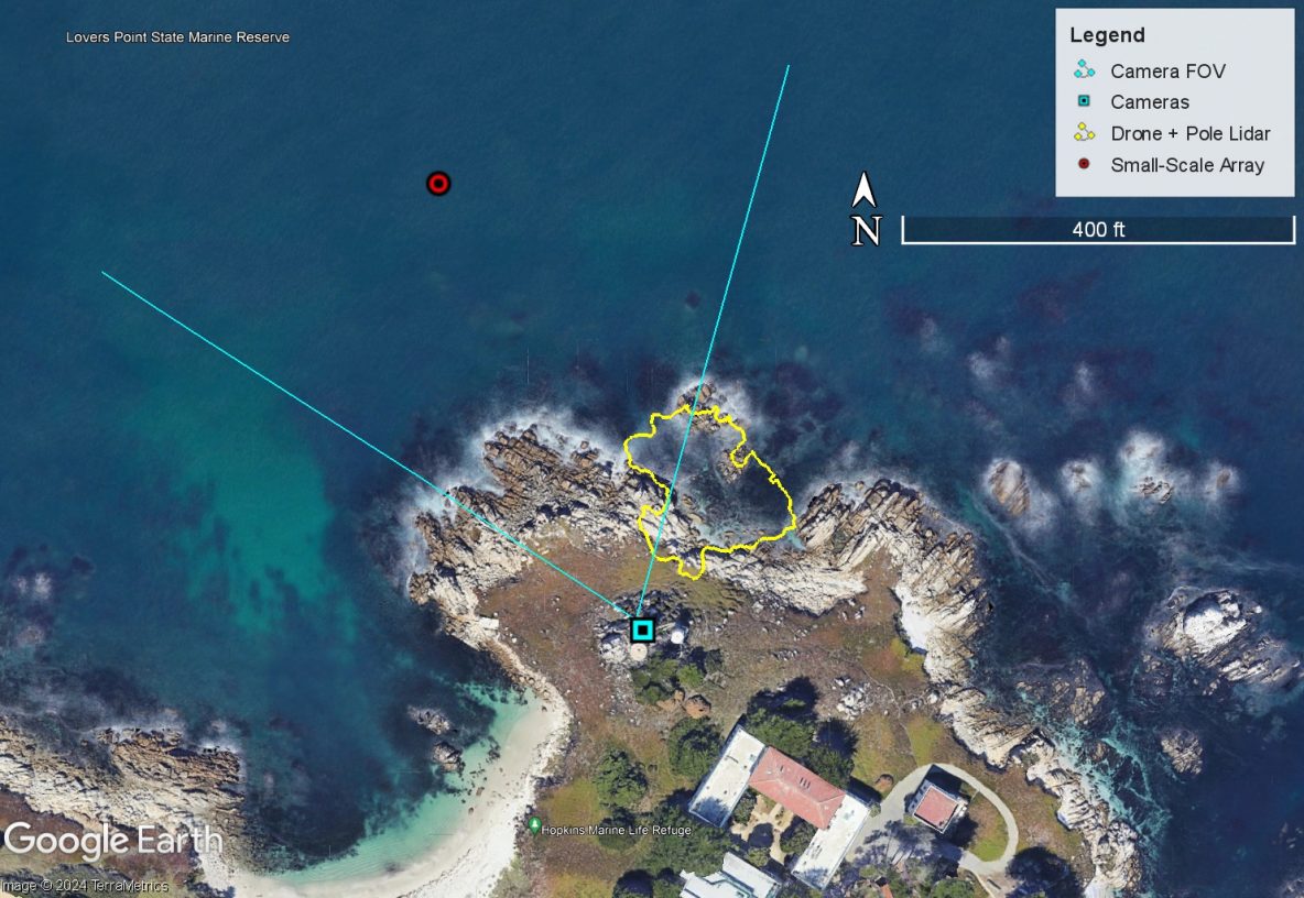
Tuesday July 5th: mayday call and large- and small-scale array operations

The morning was extremely foggy but with no wind and very small waves. We pushed off the dock and ran out to China Rock to shoot, check, or replace a number of instruments. We started with the B01s spotter which was not communicating. Rebooting it didn’t help and Jamie determined it needed to be replaced. Rob and Kent dove B02 … Read More
- Page 1 of 2
- 1
- 2