

In late June 2024, scientists from Scripps Institution of Oceanography, Naval Postgraduate School, University of North Carolina, and University of the Virgin Islands performed preparatory fieldwork for the next “steep cliffs” ROXSI experiment for Winter 2024-25. The preparatory field work was conducted along the cliffs near Bordeaux Bay in St. Thomas from June 18-20. In order to mount pressure sensors … Read More
2023 Field Experiment at Hopkins Marine Station – OSU Remote Sensing Data
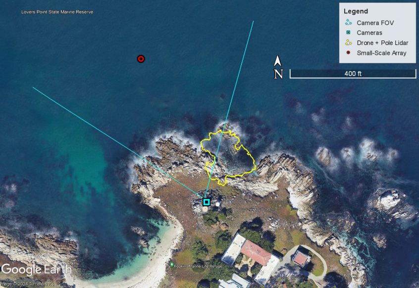
The second field experiment of ROXSI was completed from September-November 2023 at Stanford University’s Hopkins Marine Station. The field experiment included lots of instruments in the water and affixed to rocks, called the Small-Scale Array, as well as shore-cameras and drone measurements. There were some warm days, some cold days, some windy days, some spooky days (Halloween), some big waves … Read More
ROXSI UAV hover of synchronized lidar and georectified images of wave propagating through rocky coast
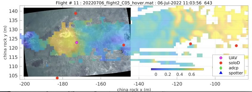
As part of the ROXSI project, we are interested in how surface gravity waves propagate and dissipate through very shallow yet very rocky and rough regions. As part of this we are using a UAV with lidar and camera system to visualize the wave field in places that are challenging to sample in any other way. It took some work … Read More
All instruments back in the lab
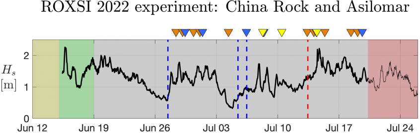
After a busy month and a half, we have officially wrapped up the 2022 ROXSI field experiment! Our boat and shore crews did a superb job and recovered all of our moorings in just a few days. Since algae and kelp are more than happy to grow on our instruments, the first step back in the laboratory is to … Read More
ROXSI nowcast wave model performance
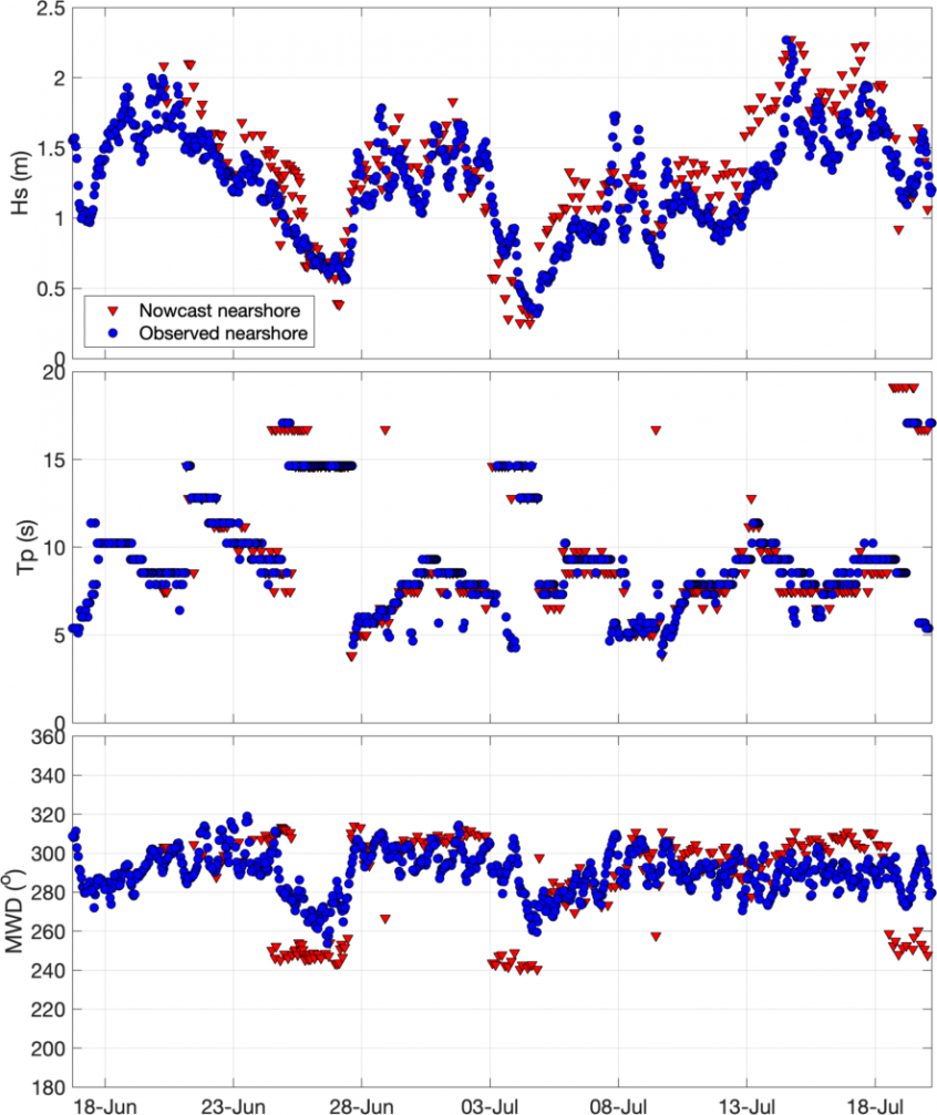
As we wrap up the field program for ROXSI 1, I wanted to revisit the nowcast model performance compared to one of the nearshore wave observations (Quick side note: instrument recovery was a spectacular effort from land and sea by everyone involved!). A reminder, the ROXSI nowcast takes bulk wave spectral characteristics from a real-time offshore NDBC buoy (40 km … Read More