
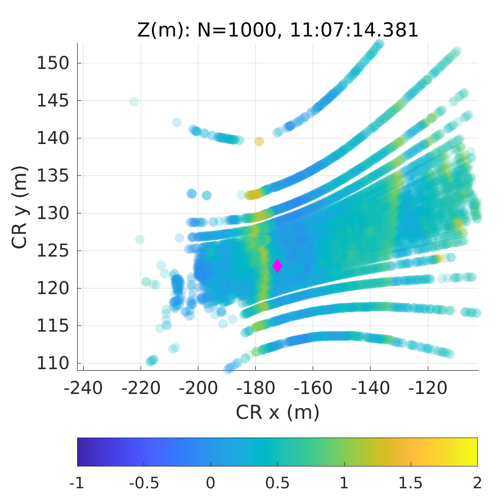
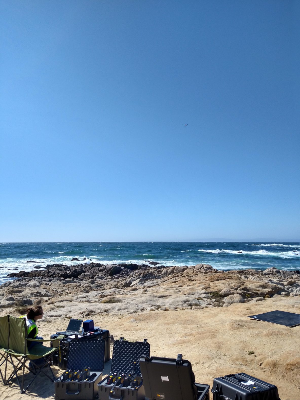
Over the past two weeks the SIO group has also been doing UAS flights with lidar but at China Rock. See Matt’s post from July 16th at Asilomar. Similar to the Oregon State group, our strategy has been principally to hover in space for ~12 minutes usually over an instrument – see the China Rock instrument map below. An example … Read More
Saturday July 16 – Measuring Waves from the Sky
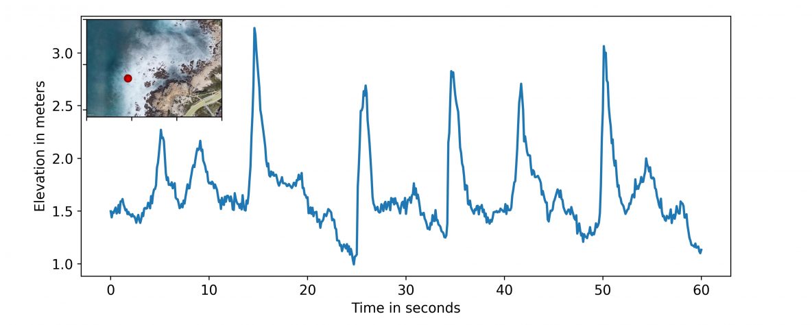
When you imagine going to the beach, what’s the first thing you think of? Perhaps it’s sand or sun, perhaps it’s rocky intertidal areas, or perhaps it’s waves. Those waves that you may love to surf are also a critical aspect of coastal systems from many different perspectives. As waves approach the shore and break, they bring energy and momentum … Read More
July 6th: UAS Bathymetric Survey of China Rock region

On Wed July 6th, a UAS survey of the low-tide bathymetry / topography of China Rock was completed. A lawnmower pattern was flown at 50 m above the takeoff deck at a speed of 6 m/s. The survey itself took about 13 min at low-tide. Rob then processed the lidar data and colorized it with the camera images. The result … Read More
Friday July 1st : UAS Lidar surveys at China Rock
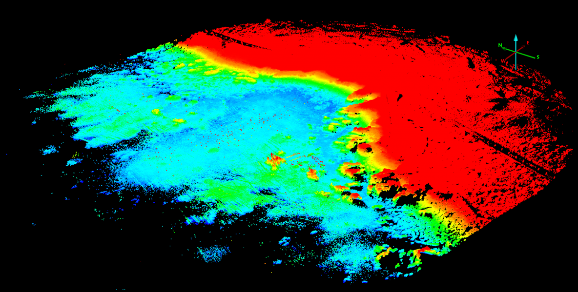
Friday Morning we continued our UAS lidar surveys of China Rock. In particular we focussed on cross-shore transects along the B-line, C-line, and A-line of China Rock. The data returns are excellent. Below is a image of uncorrected lidar returns for the B-line only.The entire bay of China Rock and the headlands are beautifuly visualized. These A-line, B-line, and C-line … Read More
Asilomar From Above
Oregon State’s camera tower was parked along Sunset Drive on June 16, and has been collecting video near continuously since then to observe waves and currents over the Asilomar ROXSI study area. Three cameras are at the top of the tower, overlooking Pico Bay, the cross-shore instrument array, and the southern shoreline. Foam drifting on the water surface has revealed … Read More
- Page 1 of 2
- 1
- 2