Welcome to the ROXSI web site
What does ROXSI stand for? Rocky shOrelines eXperiment SImulation
The ONR-funded MURI, ROXSI (ROcky shores eXperiments and SImulations) is to study the coastal ocean dynamical processes of rocky shores essential to Navy operations through combined in situ and remote sensing observations, and high-fidelity CFD and community models. 75% of the world’s coastlines are rocky, limiting current Naval accessibility. By avoiding these rocky shores, the Navy is predictable. In contrast to well-studied sandy shores, rocky shores are inherently multiscale with complex three-dimensional geometries at scales of cm to 100s m. Multiscale bottom variability strongly affects wave processes, such as scattering, reflection, nonlinear energy transfers, and dissipation that are dramatically different from sandy beaches. Rocky shores will strongly affect water-column turbulence, wave-driven inner shelf, and surf zone currents.
Four central California field experiments will occur from Big Sur across the Monterey Peninsula, spanning different canonical rocky shores, based on bottom roughness from existing high-resolution bathymetric surveys, shoreline type and complexity, and wave climate. The proposed experiments use nested in situ arrays and remote sensing to capture wave and circulation gradients and processes at different scales. The arrays will extend from 40-m water depth through the intertidal zone and span a few kilometers along the shore. The instrument arrays will be arranged along lines parallel and perpendicular to shore to synchronously and asynchronously measure wave transformation and circulation patterns across scales of 10 m - 1 km. For <10 m scale, a small-scale coherent array will be deployed around rocky obstacles to make detailed measurements of processes that dissipate energy and alter wave properties. Ground- and UAS-based lidar and optical remote sensing will measure the time-evolving 2D wavefield from the intertidal to offshore, capturing the transformation of nonlinear directionally-spread waves propagating over complex rocky bathymetry, wave breaking and dissipation, and wave-induced currents via foam streaks.
The applicability of existing nearshore models developed for low-sloped, sandy beaches in predicting rocky shores wave propagation, circulation, and turbulence is unknown, nor is what new physics must be included to make accurate predictions. A suite of numerical model simulations will quantify fundamental water column processes, wave transformation (such as relative importance of wave scattering and dissipation due to bottom friction), and circulation dynamics on rocky shores. High-resolution simulations for bottom features guided by the measured bottom geometries will determine flow separation and eddy shedding effects and improve bottom friction parameterization in community ocean models. The ROXSI field observations will validate the various numerical models to improve existing parameterizations from the inner-shelf to the intertidal zone.
ROXSI is a collaboration between scientists from UCSD's Scripps Institution of Oceanography, Naval Postgraduate School, University of North Carolina, Oregon State University, Stanford's Hopkins Marine Station, University of Delaware, and University of Washington.
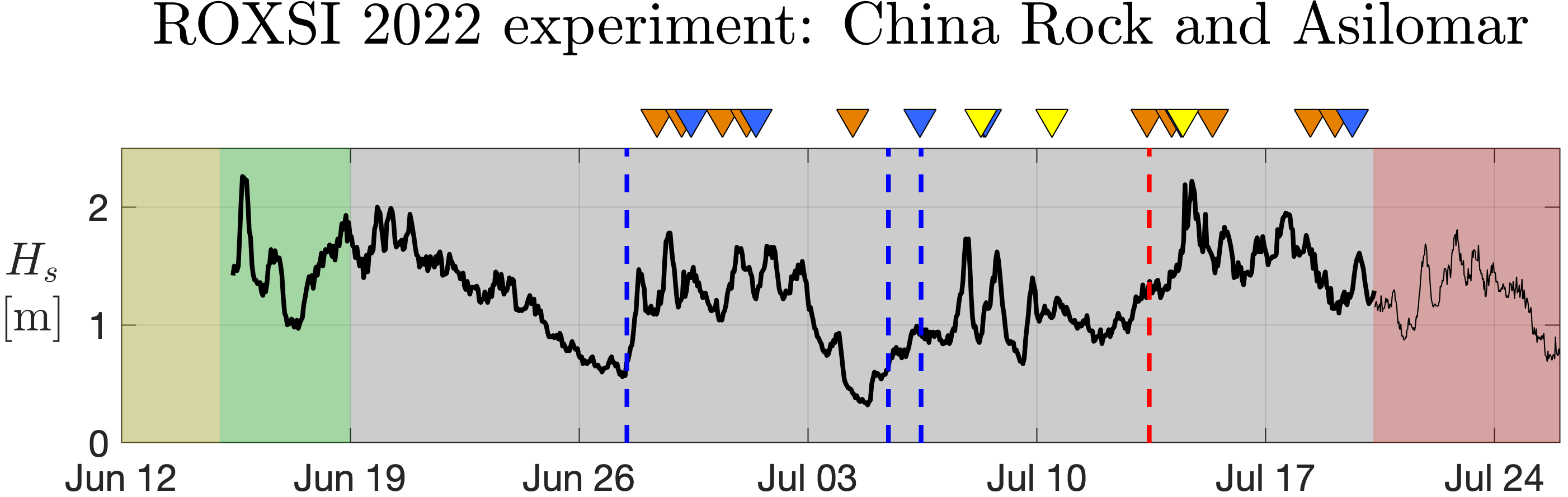
The first ROXSI field experiment is over the June-July 2022 time period and is located at Asilomar State Beach in Pacific Grove and China Rock in Pebble Beach. We have an extensive set of permits including from the Monterey Bay Marine Sanctuary, California State Parks, California Dept of Fish and Wildlife, and the Pebble Beach Corporation. See the posts below get all the updates on the field work!
Latest Posts
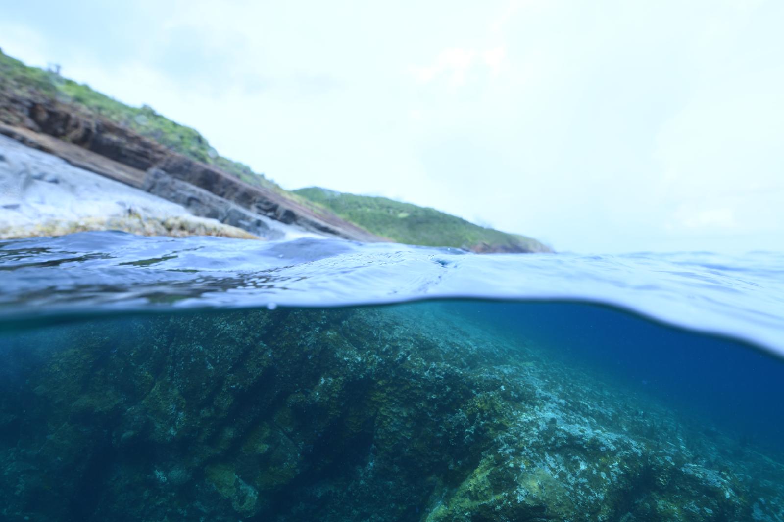
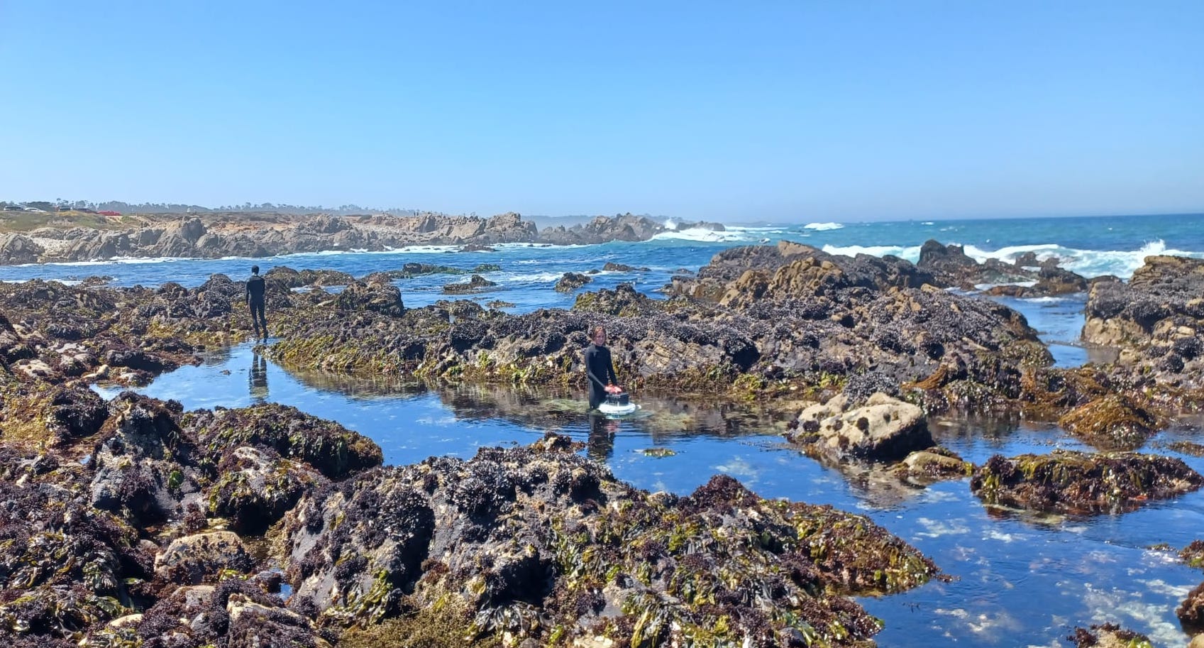
June 2024 St. Thomas Field Work Prep
kpick
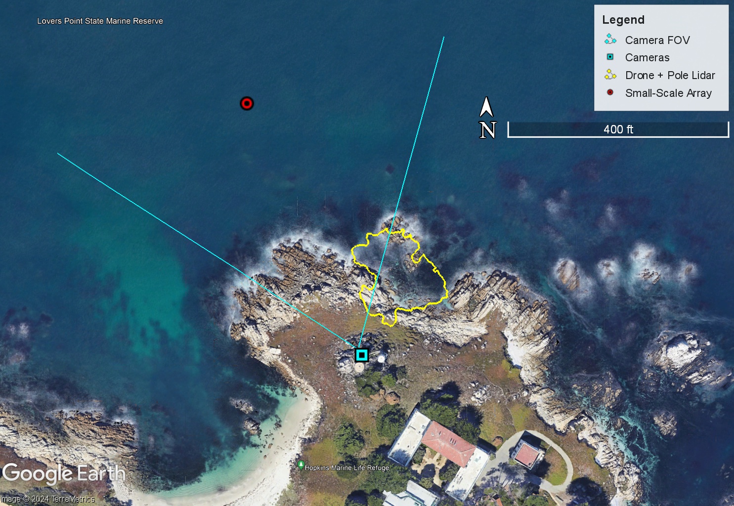
2023 Field Experiment at Hopkins Marine Station – OSU Remote Sensing Data
conlinm
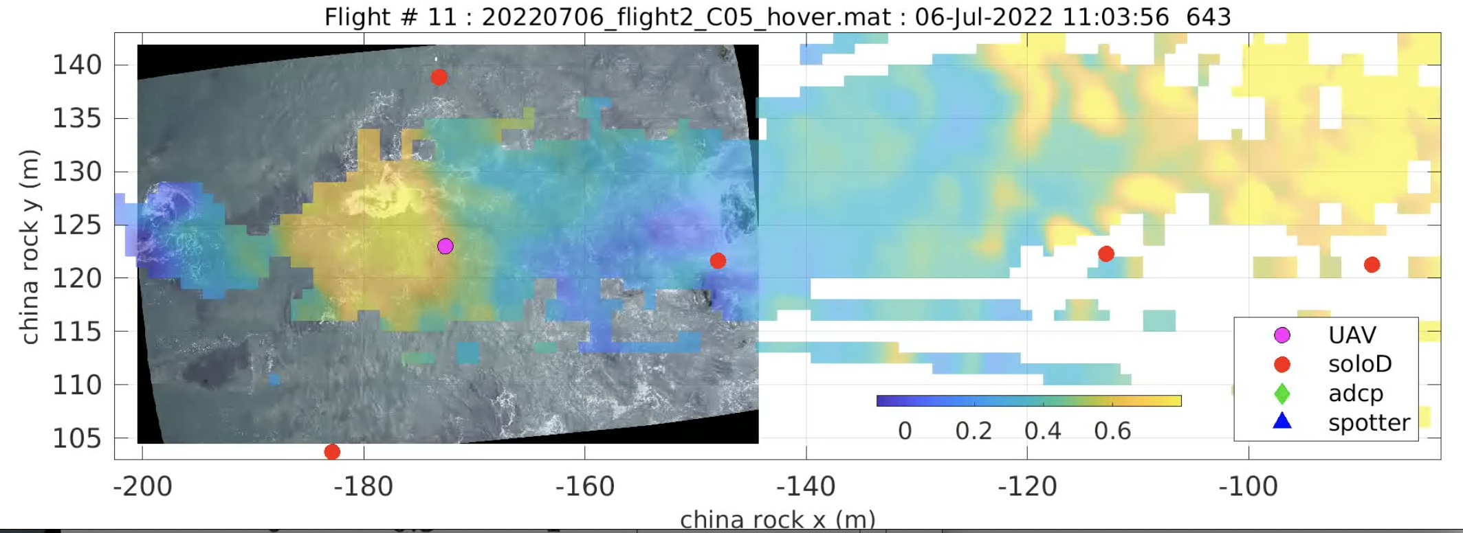
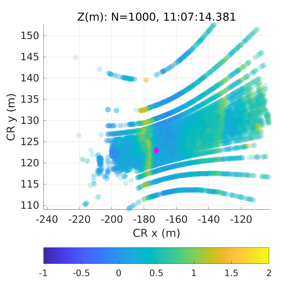
ROXSI UAV hover of synchronized lidar and georectified images of wave propagating through rocky coast
ffeddersen
All instruments back in the lab
omarques
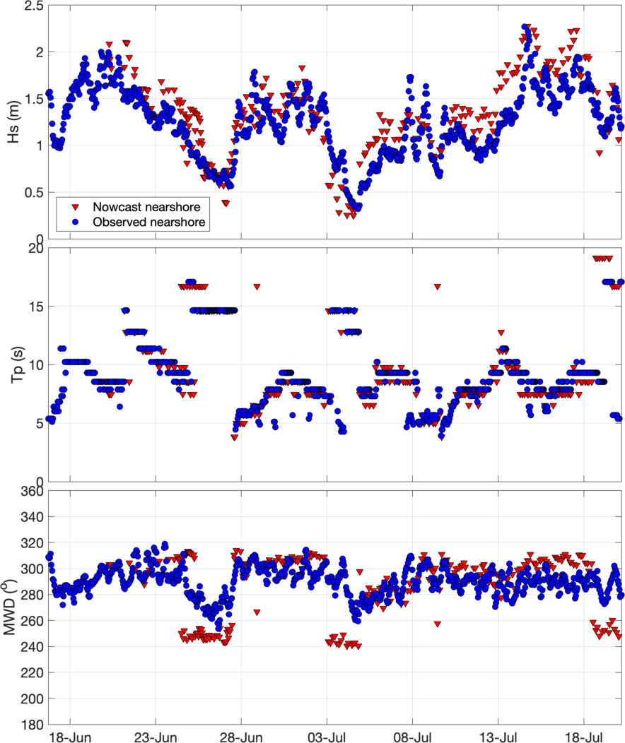
ROXSI nowcast wave model performance
suandas