
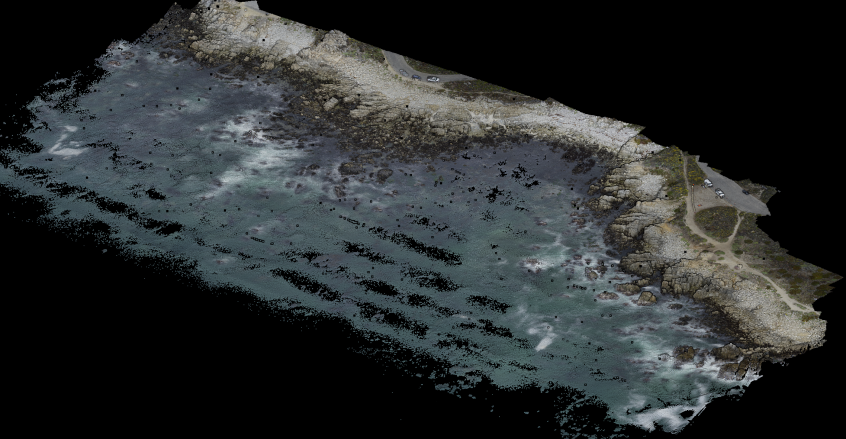
On Wed July 6th, a UAS survey of the low-tide bathymetry / topography of China Rock was completed. A lawnmower pattern was flown at 50 m above the takeoff deck at a speed of 6 m/s. The survey itself took about 13 min at low-tide. Rob then processed the lidar data and colorized it with the camera images. The result … Read More
Tuesday July 5th: mayday call and large- and small-scale array operations

The morning was extremely foggy but with no wind and very small waves. We pushed off the dock and ran out to China Rock to shoot, check, or replace a number of instruments. We started with the B01s spotter which was not communicating. Rebooting it didn’t help and Jamie determined it needed to be replaced. Rob and Kent dove B02 … Read More
UAS lidar and photo survey day at Asilomar

When flying our drone Asilomar State Park, we and the Parks rangers are often asked if we’re looking for sharks or other wildlife in the water for our research. While the answer is generally “not-really” — our goal is to measure the waves and currents in the nearshore — we do in fact get beautiful views of the seabed and … Read More
ROXSI nowcast wave model
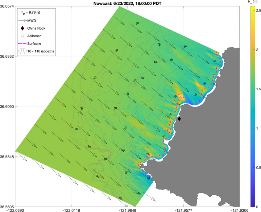
We are developing a suit of regional-to-local scale wave models for ROXSI using the COAWST modeling system. One such product is our nowcast wave model using a series of three nested SWAN grids with successively higher resolution. In its current incarnation, every 4 hours we initialize a model with the latest hourly bulk wave spectral characteristics in the region available … Read More
Friday July 1st : UAS Lidar surveys at China Rock
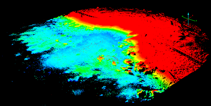
Friday Morning we continued our UAS lidar surveys of China Rock. In particular we focussed on cross-shore transects along the B-line, C-line, and A-line of China Rock. The data returns are excellent. Below is a image of uncorrected lidar returns for the B-line only.The entire bay of China Rock and the headlands are beautifuly visualized. These A-line, B-line, and C-line … Read More