
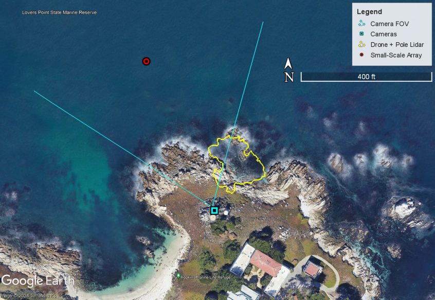
The second field experiment of ROXSI was completed from September-November 2023 at Stanford University’s Hopkins Marine Station. The field experiment included lots of instruments in the water and affixed to rocks, called the Small-Scale Array, as well as shore-cameras and drone measurements. There were some warm days, some cold days, some windy days, some spooky days (Halloween), some big waves (almost 10 feet) and some small waves. Overall, lots of data were collected and it was a fine success. The map above shows the locations of all the data.
Oregon State University’s large drone has a high-resolution camera and advanced lidar sensor attached to it. The drone hovered over a transect of points along a surge channel, inside and just beyond the yellow area in the map above. Images from the camera were used to estimate flow speed and direction of the water surface, while the lidar measured the elevation of the water surface. In the image below, the left panel shows time-averaged water surface velocity estimates as a map. In the right panel, timestacks of water surface velocity and elevation are shown, where the horizontal axis is an along-channel transect and the vertical axis is time. In the along-transect velocity, pulses of high velocity (yellow) are visible, representing flow exiting the surge channel, as has been observed in previous studies. In the water surface elevation data, the paths of individual waves are visible as sloped lines, while the vertical yellow line is the location of a rock.
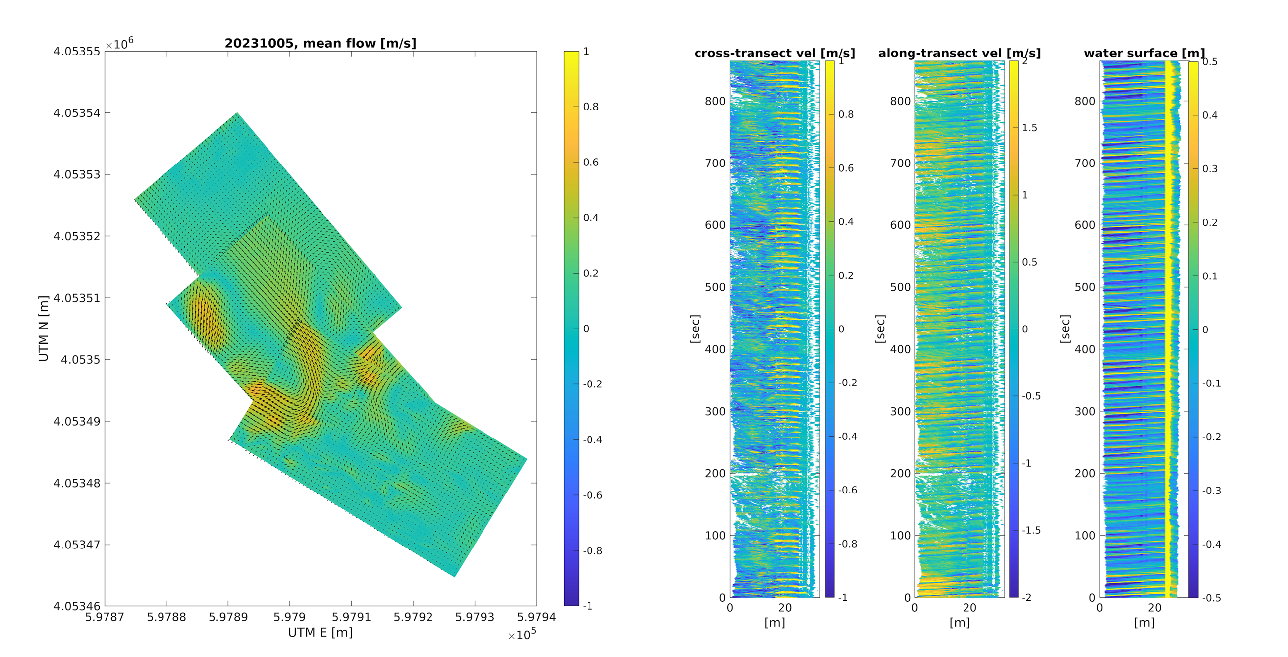
Water surface velocity and elevation estimates from OSU’s drone-based lidar.
Then, the lidar was removed from the drone and attached to a pole, and at very low tide the pole-mounted lidar was used to measure the seafloor beneath the drone-based measurements. This is shown in the figure below, where the right panel shows an example of the data in a 5 m x 5 m square. Over 300 million points were collected! When combined with the drone-based measurements of water surface velocity, this could be a valuable dataset to explore how energy and forces are transformed in rocky nearshore environments.
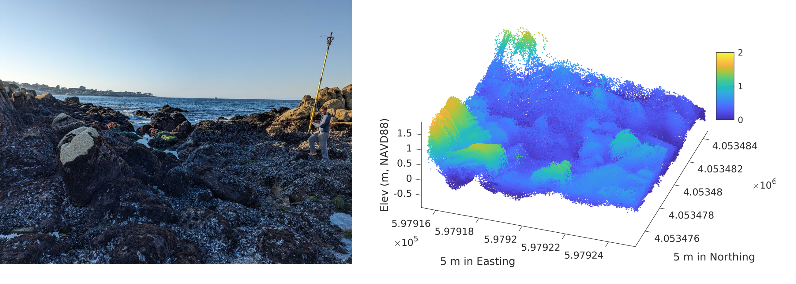
Pole-mounted lidar observations of the seafloor beneath the drone-mounted lidar observations.
OSU also deployed a video camera tower on shore, with 3 cameras overlooking the rocky nearshore. The system stood sentinel for 25 days, collecting nearly continuously during daylight hours. Two of the three cameras were deployed in a stereo configuration – where their overlapping fields of view allows for reconstruction of the 3-dimensional water surface from their images. The bottom right panel in the figure below shows an example timestack of surface elevation from the stereo reconstruction. Again, the paths of individual waves are visible as sloped lines. The stereo water surface reconstructions and other data from the cameras are being used to investigate processes including water surface transport speeds/directions and reflection of waves.
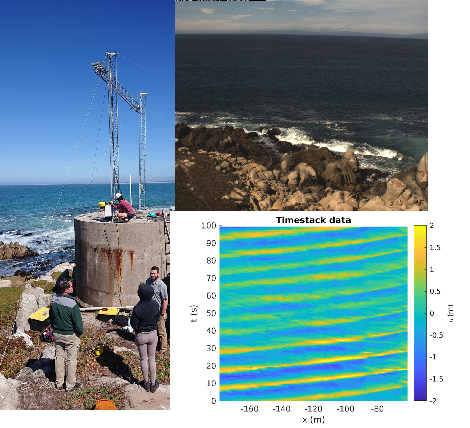
OSE camera tower and camera observations.