

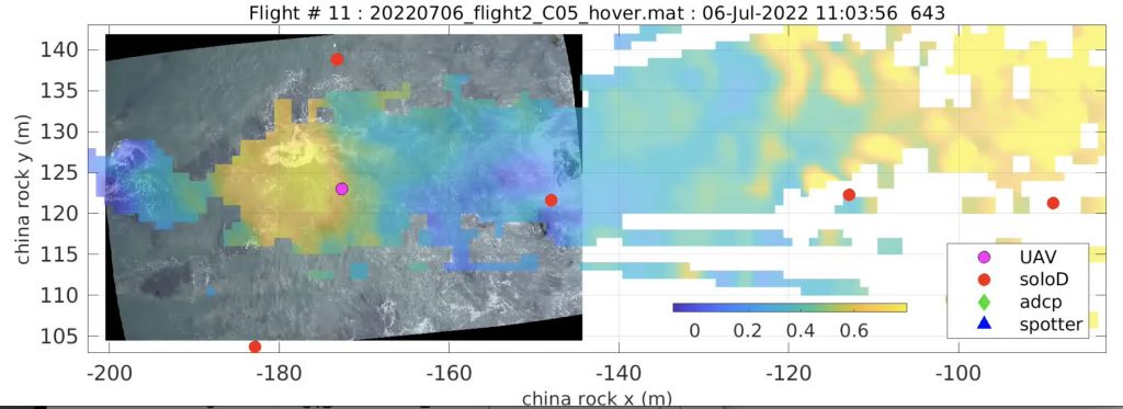
As part of the ROXSI project, we are interested in how surface gravity waves propagate and dissipate through very shallow yet very rocky and rough regions. As part of this we are using a UAV with lidar and camera system to visualize the wave field in places that are challenging to sample in any other way. It took some work (thank you Julie Fiedler, Athina Lange, and Alex Simpson) to get the georectification going. Now we have synchronized lidar and photos and the resulting movies are pretty neat.
The opaque coloring is the sea surface elevation by min meaning the lidar data. The camera image is underneath. The lidar coverage is far larger than the camera. The magenta dot is the (x,y) location of the UAV and the red dots are locations of pressure sensors. We can see waves propagating about 100 m into the pinacle laden shoreline. Reflections off of the rocks is also quite visible. We have multiple hovers at this region under different wave conditions.