
As part of the ROXSI project, we are interested in how surface gravity waves propagate and dissipate through very shallow yet very rocky and rough regions. As part of this we are using a UAV with lidar and camera system to visualize the wave field in places that are challenging to sample in any other way. It took some work … Read More
July 17th: More measuring waves from sky at China Rock
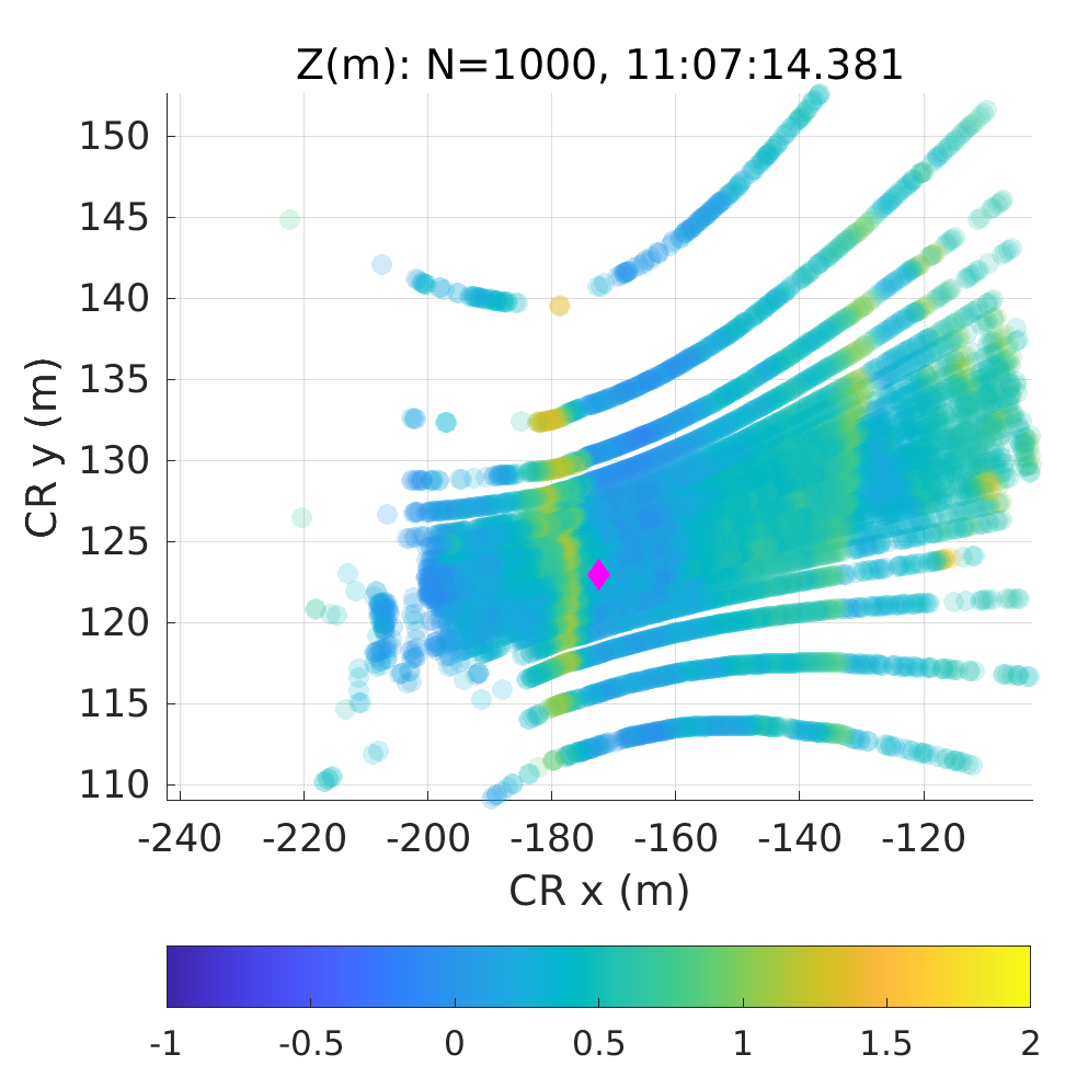
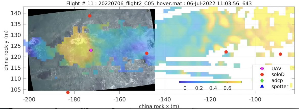
Over the past two weeks the SIO group has also been doing UAS flights with lidar but at China Rock. See Matt’s post from July 16th at Asilomar. Similar to the Oregon State group, our strategy has been principally to hover in space for ~12 minutes usually over an instrument – see the China Rock instrument map below. An example … Read More
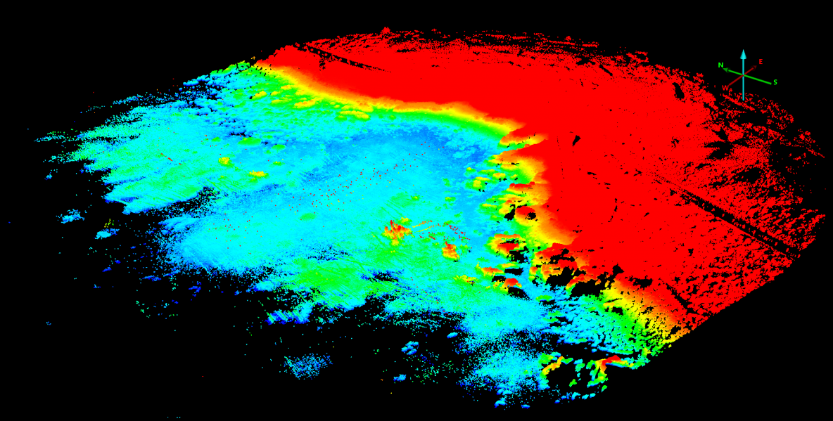
July 6th: UAS Bathymetric Survey of China Rock region

On Wed July 6th, a UAS survey of the low-tide bathymetry / topography of China Rock was completed. A lawnmower pattern was flown at 50 m above the takeoff deck at a speed of 6 m/s. The survey itself took about 13 min at low-tide. Rob then processed the lidar data and colorized it with the camera images. The result … Read More
Tuesday July 5th: mayday call and large- and small-scale array operations

The morning was extremely foggy but with no wind and very small waves. We pushed off the dock and ran out to China Rock to shoot, check, or replace a number of instruments. We started with the B01s spotter which was not communicating. Rebooting it didn’t help and Jamie determined it needed to be replaced. Rob and Kent dove B02 … Read More
Friday July 1st : UAS Lidar surveys at China Rock
Friday Morning we continued our UAS lidar surveys of China Rock. In particular we focussed on cross-shore transects along the B-line, C-line, and A-line of China Rock. The data returns are excellent. Below is a image of uncorrected lidar returns for the B-line only.The entire bay of China Rock and the headlands are beautifuly visualized. These A-line, B-line, and C-line … Read More
- Page 1 of 2
- 1
- 2