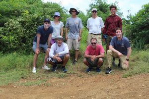
ROXSI St. Thomas Field Crew June 2024 – SIO, NPS, and UNC-Chapel Hill
In late June 2024, scientists from Scripps Institution of Oceanography, Naval Postgraduate School, University of North Carolina, and University of the Virgin Islands performed preparatory fieldwork for the next “steep cliffs” ROXSI experiment for Winter 2024-25. The preparatory field work was conducted along the cliffs near Bordeaux Bay in St. Thomas from June 18-20. In order to mount pressure sensors and current meters on the submerged rock, instrument frames have to be screwed into the rock requiring first drilling the appropraite holes. Divers used rectangular steel templates to guide the drilling of holes with underwater drills. The steel templates had to be lift-bagged to move from one location to another. Metal inserts were installed in each hole to accommodate bolts. To facilitate future location identification, each site was marked with a polypropylene line attached to an eyebolt.
This marked the first stage of a three-phase fieldwork operation. With the prep work completed, ADCPs and pressure sensors are scheduled for installation in November 2024. The instruments will be recovered in March 2025 after they have collected data throughout the active storm season.
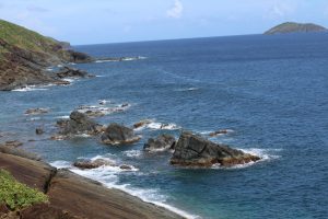
View from atop the cliff towards the western part of Bordeaux Bay
Day 1 (6/18/24):
The crew embarked on our adventure using a University of the Virgin Islands (UVI) R/V and a local dive charter boat from Admiralty Dive Center. Departing from the UVI dock, we navigated around the west coast of St. Thomas to a remote site on the island’s northern end to begin our field deployments. While divers waited aboard the dive boat, the rest of the team donned their fins and paddled around the field site on boogie boards, marking the desired instrument locations with floats for the dive crew to identify. The air was hot, the water was a comfortable 86°F, and the conditions were glassy, flat, and stunningly beautiful—perfect for fieldwork. Thanks to the excellent conditions, the crew managed to set up more instrument locations than initially planned, leaving relatively few water locations to tackle on the second day.
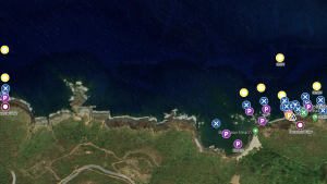
Planned instrument locations
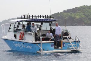
Admiralty Dive boat crew sweating in the heat just before their first dive
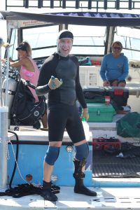
Rob Grenzeback having a jolly old time aboard the dive boat
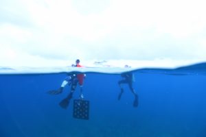
Rob and Brian swimming with the steel template, tools, and lift bag
Day 2 (6/19/24):
The crew efficiently tackled the remaining sites on the eastern end of the field area before moving to the western end to complete the remaining sites. Thanks to the experience gained on the first day, the team operated with increased efficiency, resulting in a relatively quick day on the water. Johanna and Tony worked on taking photos of the deployment site with a DSLR camera in a waterproof housing. The images were then stitched together using structure-from-motion techniques to create a map of the bottom around the deployment site. After covering all underwater locations, the field crew packed up their water gear and began to prepare for a day of deploying pressure sensors along the cliff face above water.
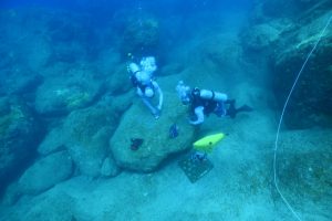
Kanoa and Kent tightening down bolts on the rock
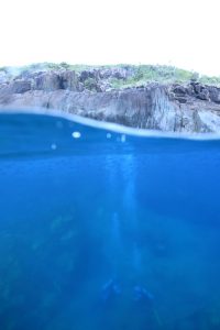
Kent and Kanoa doing their work while fish swim above
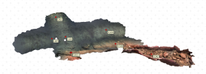
Deployment site SFM (Structure-From-Motion) image created by Anthony Whipple with photos taken by Johanna Rosman. Instrument locations are overlayed on top
Day 3 (6/20/24): Cliff Work.
The final day of operations was dedicated to preparing the cliff face for pressure sensor deployments scheduled for November. This involved drilling holes and installing inserts and bolts, but above water this time. Accessing the top of the cliffs was challenging, requiring us to drive down a rough dirt road with a 4WD vehicle and navigate through dense underbrush. Upon reaching the site, we carefully scaled down the cliff face. Rob set up a belay system to safely lower Kent to the bottom of the cliff, where he drilled several holes from the waterline up the cliff and in line with submerged instrument locations. Pressure sensors will be mounted at these locations. The locations chosen were mostly above the water due to the calm conditions of the day. However, on days with larger waves, the goal is to detect the wave runup as they rush up the steep cliff face.
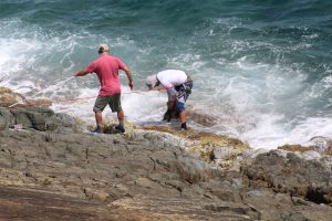
Kent drilling in the final holes down at the water’s edge while being belayed by Rob, with help from Jamie and Kanoa
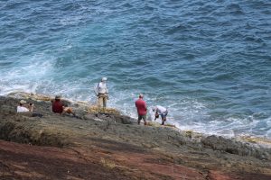
The team watching while Kent gets in the splash zone to do some drilling
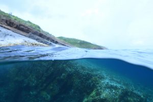
Two completely different landscapes on this exposed rock face

