
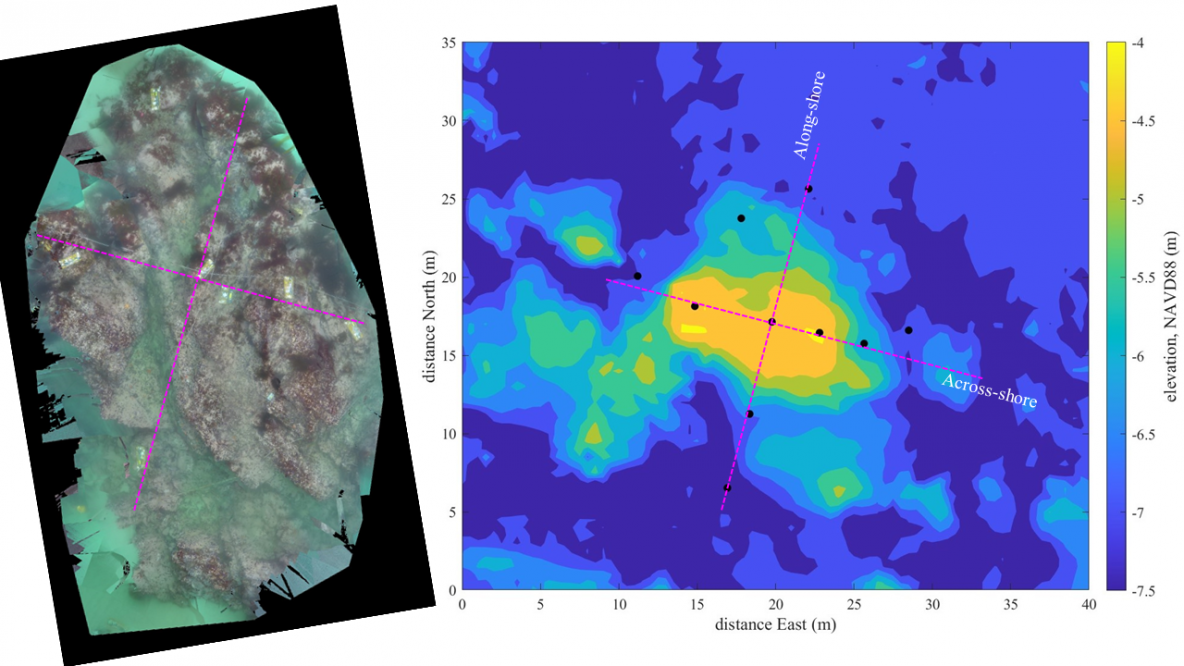
Left: Ortho mosaic of the instrumented rock at Asilomar, obtained by stitching GoPro photos. Right: multibeam bathymetry with instrument positions indicated by black dots. Magenta lines are across-shore and along-shore transects along which instruments were placed. On the last day deploying instruments in the small-scale array, visibility was amazing and we could even see the instruments from the surface. Loren … Read More
Sat & Sun June 11 & 12: Finding a Rock for the Small Scale Array
Site recon started this weekend for the small scale array. Tony and Johanna dove on three sites off Asilomar that had been selected from ETrac bathymetry surveys and Google Earth images. We chose a large rock in 4-8 m water just north of the large-scale array, which had some nice-looking flat spots at the top for mounting instruments. A surface … Read More